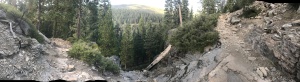
It took a bit longer than I wanted to cook breakfast this morning, but it was delicious. I made a scramble out of the eggs, potatoes, and sausage I got from the day before. I munched on the cherries and had coffee while patiently cooking my meal. After such a great start to the day I was able to hike some good miles. Below is a typical view for me throughout the day. It’s a panoramic shot that spans just shy of 180 degrees. The path, as you see, is rocky and uneven, but the view is amazing.
My hike today brought me to views like above, to dipping down into the forest and crossing a ‘hiker bridge’ like below, … ( A hiker bridge seems to be anything that spans water that a hiker may use to get across, whether it be a log that fell naturally to branches and logs placed by hikers to assist in the crossing. )
![IMG_4054[1]](https://iknowdavetondu.com/wp-content/uploads/2017/09/img_40541.jpg?w=225&h=300)
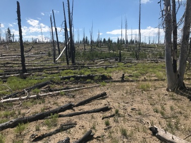
… To dead forest, where the trail was covered in ash from a fire in a prior year, …
… To mountain peaks popping up in the distance. It was another full day

After crossing a lot of miles I ended up setting up camp in the dark just outside a place called Old Station RV Park. No campsite, just picked a level spot right off trail. I had first stopped near the RV park and a camper asked if I wanted a ride to the gas station/diner, JJ’s, up the road. Apparently you could camp in there backyard. I declined. When I finished walking the few miles to JJ’s the next morning, I grabbed breakfast and saw him again with his family. We struck up a nice conversation that passed the time while I charged my phone and made plans for the next section.
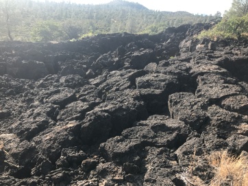
Just a couple miles up the trail there was a lava tube called Subway Cave. It was formed by a lava flow that happened many, many years ago. I took the slight detour to check it out then continued on toward Hat Creek Rim.
Hat Creek Rim is known for being one of the hottest parts of Northern California. That would be true. The ground itself was hot. The trail consistently was made up of black lava rock, and it retained a lot of heat.
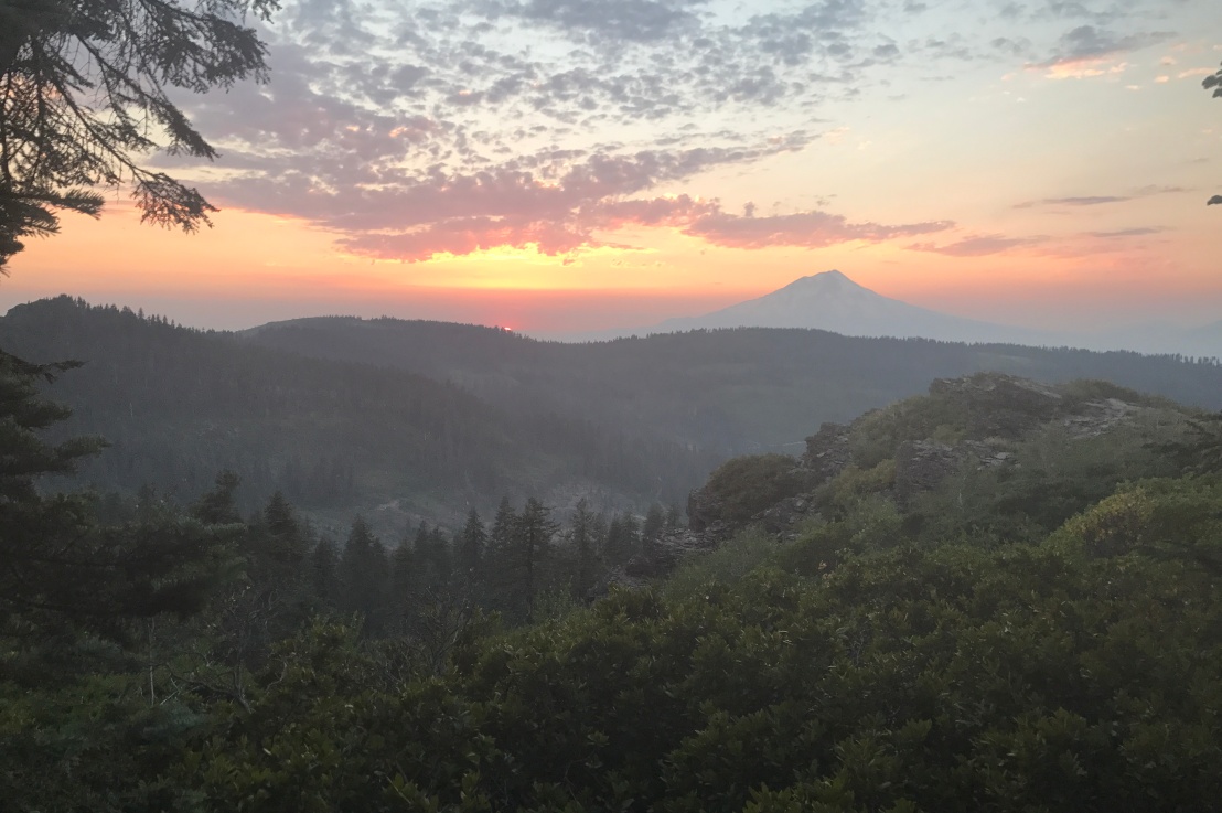
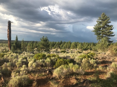
I camped up on top of the rim and was treated with two spectacular views. One was of a storm forming over the topography miles away.
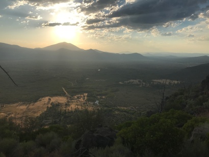
The other was my dinner view.
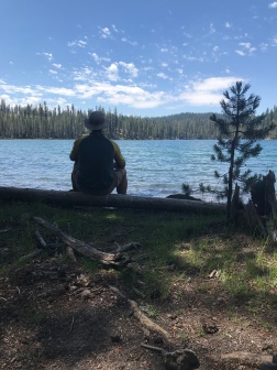
The next morning I awoke and headed to the next water source, Lost Creek. It happened to be 400 feet below the trail. Many people skip this and go for the easier one ten miles up the trail that’s called Cache 22. (Get it?) The hike down to Lost Creek, because of its steepness, does take a bit of time. I think it took me upwards of 20 minutes to make it down. I was greeted with a nice surprise though. As I was filling up, a pair of hummingbirds came over to me and hung out within arms reach. They just hovered and watched me while I filled and filtered my bottles. I only got one picture, and it didn’t come out very well. They seemed very camera shy.
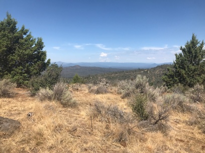
The hike on Hat Creek Rim affords a constant view of Mt. Shasta in the distance. I was inspired and even made a quick video for home before moving on from this spot.
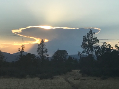
I did also stop at Cache 22 where a handful of other hikers were as well. We hunkered down under the shade of a tree and ate our lunches while trying to stay cool. I did around 24 miles before setting up camp in the dark again, but not before getting rained on, and then seeing a classic anvil head storm cloud.
The next morning I took a short hike to a place called Burney Mt. Guest Ranch. Super cool place. They have a great set up for hikers; showers, a place to camp, convenience store, and meals for a nominal fee. I spent the morning and early afternoon there before pushing off again. Upon leaving I noticed what I thought to be mountain lion tracks alongside hoof prints. I’m glad the lions have something else to munch on beside me.
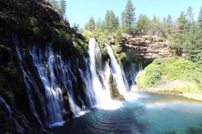
Next stop was Burney Falls. An amazing place! I recommend going there, seeing that it’s a full tourist spot with t-shirts and mugs and typically overpriced snacks. It really is a site to behold. This picture was given to me by another hiker there, Shrimp/Cookie Dog.
I arrived on Friday but had to wait for my next package to arrive on Saturday the 29th. Not a bad place to hang out though. Grabbed some beer and snacks from the store, relaxed and took a zero on Saturday. Also jumped in the pool at the base of the falls. It. Was. Cold. They say it’s between 42 and 48 degrees. It felt colder, and it was exhilarating!
Left Sunday morning early and got some good hiking in. It was actually a pretty uneventful day. This was followed by another rather uneventful day of hiking on Monday. There was a heat wave coming on though, and it forced me to rest more during the middle of the day and hike in to dusk.
The evening of the 31st, though, was a great finish to the month. I walked into a campsite and was greeted by a doe who was happily foraging for her food. She was not bothered by me at all and walked close to me while setting up my tent. She also woke me many times during the night with her surprisingly heavy footsteps.
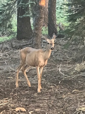
Although she was bothersome at times, I didn’t mind so much considering this was my view for the evening. This is why I’m here.

Bonus pic:
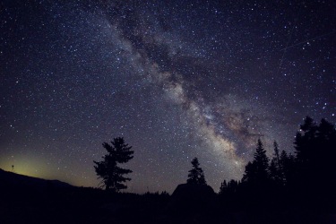
Below is another picture I got from Shrimp, before heading out from Burney Falls. This was my typical view of the night sky every night that it was cloudless. Pretty amazing.
( July 24 – July 31 )

A-M-A-Z-I-N-G !!!
LikeLiked by 1 person
That night view is amazing!!!
LikeLiked by 1 person