Truckee was an easy bus ride. I was in contact with another hiker, Lego, who was close to the area, so when I arrived in Truckee we met up so we could all hike together. Even though I skipped past the main part of the Sierras it’s still safer to not hike alone up here. There is still lots of snow on the ground and the trail is still covered in a lot of areas. This was my typical view for the day.
What trail?
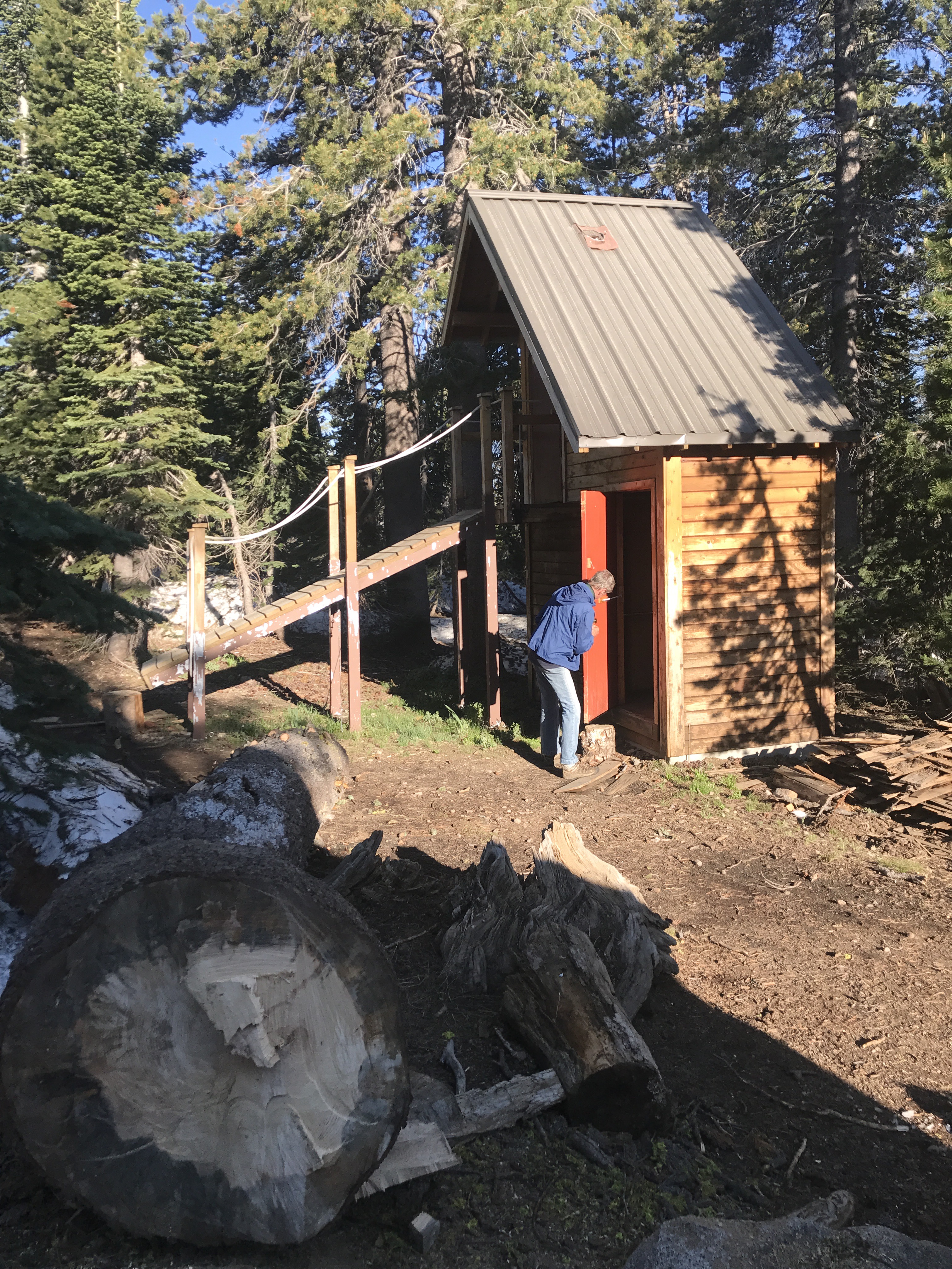
Although it seems like it, this is not the trail. We, and other hikers before us, would hike on top of the drifts between trees using our phone’s GPS apps to orient us toward where the trail should be. This went on for miles. That evening we hiked up to a cabin called Peter Grub Hut. I believe it’s maintained by the Sierra Club. When we walked in there were about 8-10 people from the Sierra Club already there. They had been doing some maintenance in the day. Three of us slept on the dirt floor in a side room where they usually kept the firewood for the winter months, and our fourth slept in the main room. The others slept upstairs in the ‘loft’. We woke early, got ready, had coffee, and used the two level privy.
Double decker outhouse!
This privy has a second level because if the snow is too high you can still get access. If you are from an area that gets their snow measured in feet, you understand. We got to hiking again and dealing with the snow patches and finding the trail. And although it was mainly for show, I took out my ice axe and carried it. I did use it as a walking pole and it helped me get up some snow banks but it wasn’t necessary and eventually I put it away. Better to have and not need than need and not have.
Wielding the Ice Axe
One funny thing about the trail is that you can be in the middle of nowhere and get cell signal, although not too often. Below is a picture I took of my hiking buddies using the hotspot off my phone because I had service and they didn’t. Interesting how it can be so beautiful and we still have innate addictions to our technology.
WIFI Hotspot!After our emailing and texting session we got to it again. All day we saw patches of snow. Some were just small splotches while others were whole fields, like the picture below. If you look closely you can see, not just the one hiker in front of me, but the two others at the tree line much further away. This is one of those spots where the trail didn’t so much exist, as much as we found it with our GPS apps. Somewhere underneath this 3-5 ft of snow was the trail and it went that-a-way. This crossing was later in the day which also meant that the snow was slushy from the sun being on it all day and we had to watch our step or get our feet wet or possibly even break through the crust.
Field of small sun cupsOne good thing about the snowfall this last winter is that in many places it created plenty of water sources. Which, for us, meant not having to carry a ton of water through this section. A few miles up the trail and you would typically run in to water coming down from the mountain. It seemed to me that a lot of it was run-off from the snow melt. Cold, clear, and delicious!
A typical water sourceNot too long until we got to Sierra City. It was a day stop for me. We got in early and relaxed. Grabbed some food for lunch from the country store. Took a cold shower. Re-supplied what I needed, sent off my bear canister, which I only used once, my ice-axe, crampons, and micro-spikes. All of which was unnecessary in this area.
Which way to Canada?After a nice long siesta in town, three of us took off again. We didn’t go very far, since it was already early evening and we didn’t have a lot of hiking energy. Most of the snow was gone by now and we walked among huge green sided mountains, but we did come across a huge snow mound/drift. The view was amazing. We stood as close to the edge as we dared and took a few pics.
Snow mound with a viewThere were lots of downed trees this year with all the snow and rain. It’s such an undertaking to clear or remove them from the trail that many miles haven’t been able to be cleared. ( A thank you goes out to the crews that are doing their utmost to try and clear them! ) It was a constant climb over, duck under, walk around, or walk across. And as you can see these are no small backyard saplings. I think that’s a good shot of my new pack too.
Pesky tree fell on the trailOver and over I find that the constant battle uphill, downhill, navigation of trees, water, snow, etc, pays off. This next picture was my camp spot after all of the aforementioned. It was stunning! What you can’t see are the hundreds of dragonflies hanging in the air presumably waiting for their meal to tumble by in the wind. They were mesmerizing. The sun was slowly setting but it was the perfect temperature. Not too hot, and not too cold. I was able to keep the rainfly off so I could look at the stars overnight.
Stunning camping spotAnd just before heading to sleep, I had a visitor. She wasn’t scared at all, and came within a feet from my tent. She stopped by all night long.
So happy and excited to be reading another posting of iknowdavetondu.com!
It’s kind of like waiting for the next installment in a mini-series or who-done-it. “What’s going to happen next?! What’s just around the corner!? Fire? Ice? Breathtaking views!? Two story out houses?!
OH MY! OH MY!


![IMG_3658[1]](https://iknowdavetondu.com/wp-content/uploads/2017/09/img_36581.jpg?w=300&h=225)
![IMG_3663[1]](https://iknowdavetondu.com/wp-content/uploads/2017/09/img_36631.jpg?w=225&h=300)
![IMG_3698[1]](https://iknowdavetondu.com/wp-content/uploads/2017/09/img_36981.jpg?w=225&h=300)
![IMG_3713[1]](https://iknowdavetondu.com/wp-content/uploads/2017/09/img_37131.jpg?w=225&h=300)
![IMG_3762[1]](https://iknowdavetondu.com/wp-content/uploads/2017/09/img_37621.jpg?w=300&h=225)
![IMG_3794[1]](https://iknowdavetondu.com/wp-content/uploads/2017/09/img_37941.jpg?w=225&h=300)
![IMG_3896[1]](https://iknowdavetondu.com/wp-content/uploads/2017/09/img_38961.jpg?w=300&h=225)
![IMG_3898[1]](https://iknowdavetondu.com/wp-content/uploads/2017/09/img_38981.jpg?w=300&h=225)

Love your blogs.
LikeLiked by 1 person
So happy and excited to be reading another posting of iknowdavetondu.com!
It’s kind of like waiting for the next installment in a mini-series or who-done-it. “What’s going to happen next?! What’s just around the corner!? Fire? Ice? Breathtaking views!? Two story out houses?!
OH MY! OH MY!
LikeLiked by 1 person